Includes course access for yourself with your Sporty's account immediately after checkout.
We'll ship you or the recipient of your choice an online activation code for this course. This physical gift packet includes one activation code and directions on redeeming the course.
We can email the recipient of your choice instant online access to the course. This is the easiest way to send someone else the course as a gift.
Garmin aera 660 GPS (Americas)
Free Shipping!
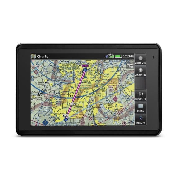
The aera 660 is the ultimate all-in-one aviation device - like a glass cockpit in the palm of your hand. It combines complete navigation features, digital charts, hazard alerts and optional in-flight weather with a beautiful 5" touchscreen.
Next generation portable GPS
With charts and 3D vision

The aera 660 is the ultimate all-in-one aviation device - like a glass cockpit in the palm of your hand. It combines complete navigation features, digital charts, hazard alerts and optional in-flight weather with a beautiful 5” touchscreen. It’s perfect for preflight planning, yoke mounting in the cockpit or for backup.
Made for aviation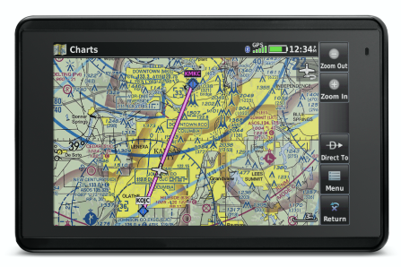
Unlike most tablets, the aera 660 is ideally suited to the cockpit. Its rugged case and built-in GPS/GLONASS receiver means you can just grab it and go flying. Once in the air, you’ll appreciate the bright, sunlight-readable screen – even if you’re flying in a low wing airplane on a summer day. The responsive touchscreen and fast map redraws make it easy to use right out of the box, with familiar Garmin features like nearest airport, VNAV, and direct-to navigation.
Powerful hazard alerts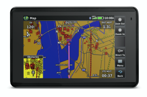
The aera 660 does a lot more than just moving maps and flight plans, with automatic alerts for nearby terrain, obstacles and traffic – even audio callouts. Smart Airspace highlights airspace close to your current altitude, while WireAware wire-strike avoidance technology warns of potentially dangerous obstacles for helicopters and low altitude airplanes.
Synthetic vision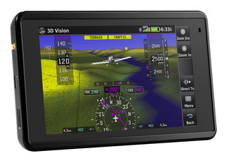
Bring the outside world to life with Garmin’s incredible 3D Vision display. You’ll see terrain, obstacles, traffic, and airport runways, which creates a complete picture of the outside environment. Add a Garmin GDL 50 with AHRS and you can even have a backup attitude indicator.
Full Electronic Flight Bag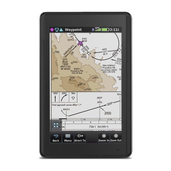
While Garmin’s data-driven basemaps are perfect for everyday flying, sometimes you need to consult the actual chart. The aera 660 includes full IFR/VFR charts (United States), fuel prices (United States), SafeTaxi diagrams and much more – it’s a complete Class I/II EFB solution. See your airplane’s position overlaid on a sectional chart, or brief the approach with actual FAA approach plates. European charts and basemaps are also available for an additional charge, making the aera 660 a truly worldwide navigator.
Connect to Garmin avionics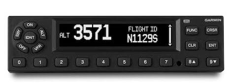
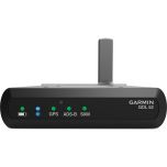
Besides its powerful built-in features, the aera 660 can also connect to a variety of Garmin avionics: receive subscription-free weather and traffic from a portable GDL 39, GDL 50 or from a panel-mount GTX 345 ADS-B Receiver; control your VIRB video camera; or send flight plans from GTN and GNS series navigators to the 660.
Built-in WiFi
Database updates are easier than ever – simply connect to a WiFi network and start downloading. Plus, more affordable database options for the US, Mexico and Canada make those cross-border trips a button push away. You can even navigate direct-to street intersections with the optional City Navigator database.
Internal battery lasts 4-6 hours; can be charged in flight with the included USB charging cable. Includes: snap-in mount, charging cable.
In the Box:
- aera 660
- Yoke mount with power cable
- Battery
- AC adapter
- USB cable
- Quick start manual and related documentation
Tech Specs:
- Physical dimensions: 5.5”W x 3.4”H x .8”D (14.1 x 8.7x 2.1 cm)
- Display size, WxH: 4.35"W x 2.61"H (11.1 x 6.6 cm); 5.08" diag (12.9cm)
- Display resolution, WxH: 480 x 800; portrait and landscape orientation
- Display type: touchscreen WVGA color TFT with white backlight
- Weight: 8.64 ounces (245 g) with battery; 7.23 ounces (205 g) without battery
- Battery: removable, rechargeable lithium-ion
- Battery life: Up to 4 hours during most daytime conditions, (80% backlight) and wireless connectivity in the cockpit, e.g. GTX 345; up to 6 hours during typical nighttime conditions, (5% backlight) and without wireless connectivity.
- SBAS/WAAS/GLONASS receiver: high-sensitivity with WAAS position accuracy
- Voltage range: 10-35
- IFR or VFR: VFR
- Traffic Information Services (TIS) alerts compatible: yes
- Accepts data cards: yes (microSD™ cards)
Database Updates
Mirroring the iPad world, Garmin has made it easier and cheaper than ever to keep your databases up to date. Downloads start at just $29.95, but the real value is the bundle pricing. Garmin offers a complete United States database subscription for just $149.95/year. This price includes airspace, frequencies, airport information, complete IFR/VFR charts, taxi diagrams, AOPA Airport Directory, obstacles and terrain. It's almost $1000 less expensive than previous database purchases, and the 660's built-in WiFi means you don't have to connect to a computer to download files.

View Pilot's Guide
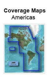
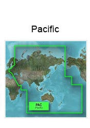
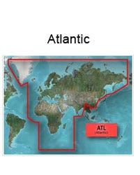
Garmin Database Area of Coverage
Americas - North, South and Central America (includes Hawaii)
Atlantic International - Europe, Africa
Pacific International - Eastern Europe, Asia, Middle East and the South Pacific (includes Hawaii)


 WARNING: This product contains, or its use may produce and expose you to, chemicals, known to the State of California as likely causes of cancer, birth defects and/or other reproductive harm. For more information on Proposition 65, please click here: