Includes course access for yourself with your Sporty's account immediately after checkout.
We'll ship you or the recipient of your choice an online activation code for this course. This physical gift packet includes one activation code and directions on redeeming the course.
We can email the recipient of your choice instant online access to the course. This is the easiest way to send someone else the course as a gift.
U.S. VFR Wall Planning Chart
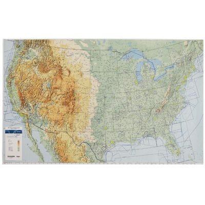
This chart is a great way to plan your next cross country flight. Printed in full color, the map displays important land data like terrain, major roads and cities. Aeronautical data includes: all airports with runways greater than 4000’, navaids, class B airspace and special use airspace like MOAs and Restricted Areas. Airports include three letter identifier for easy GPS planning. Measures 59” x 36” and ships rolled. 1:3100000 scale. A great replacement for the popular JNCA-5 chart. Chart good until 11/30/24.


