Complete Set of En Route Low Altitude Charts plus an Area Chart
Placeholder
$99.75
In stock
Backordered
For IFR navigation. Includes L/MF and VHF airways, controlled airspace, radio aids, minimum en route and obstruction altitudes, distances, reporting points, restricted areas and related data.
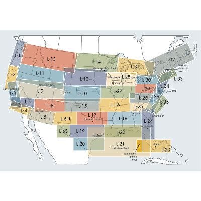
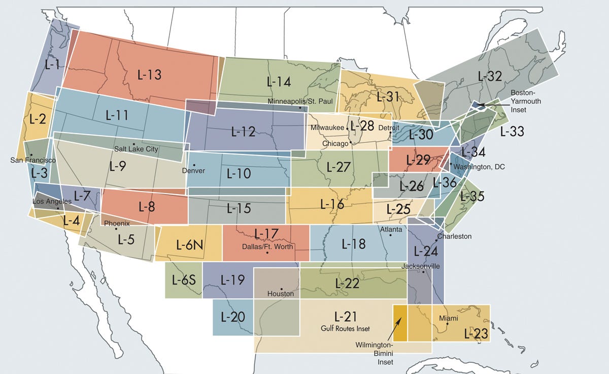
For IFR navigation. Includes L/MF and VHF airways, controlled airspace, radio aids, minimum en route and obstruction altitudes, distances, reporting points, restricted areas and related data. The blocks indicate the area the chart covers. Revised every 56 days.(Charts Obsolete 11/27/25)


