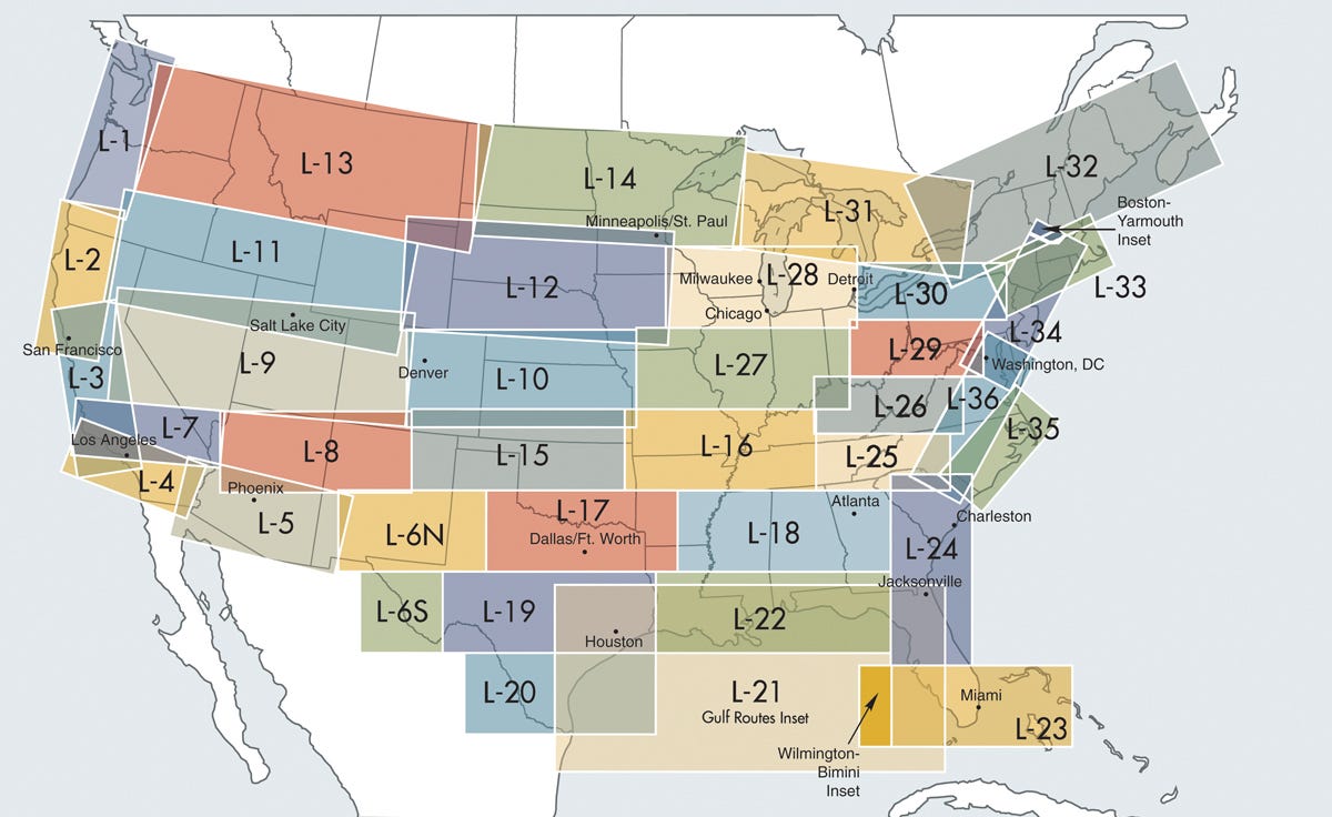
IFR Enroute Low Altitude Charts provide aeronautical information for navigation under instrument flight rules below 18,000 feet MSL. These four-color chart series includes:
Air Traffic Services
Airports that have an Instrument Approach Procedure or a minimum 3000' hard surface runway
Airways/Route Data
Cruising Altitudes
Fixes/ATC Reporting Points
Limits of controlled airspace
Military Training Routes
Off Route Obstruction Clearance Altitudes (OROCA)
Radio aids to navigation
RNAV Routes
Special Use Airspace Areas
Tabulations (MTRs, SUAs, MOAs, Airport data)
Always current charts
You will receive th most current, up-to-date charts. Revised every 56 days.
Subscription Service
Take the worry out of keeping your charts current and let Sporty's do the work for you. We can automatically send you new charts as they come available. See ordering instructions below.
Ordering information
Choose the coverage areas you need.
Enter the desired quantity next to each chart.
Choose which version of the chart you need:
Current Chart Only - you will receive the current chart (note obsolete date at top of page)
Current Chart With Subscription - you will receive the current chart and start a subscription for this chart


