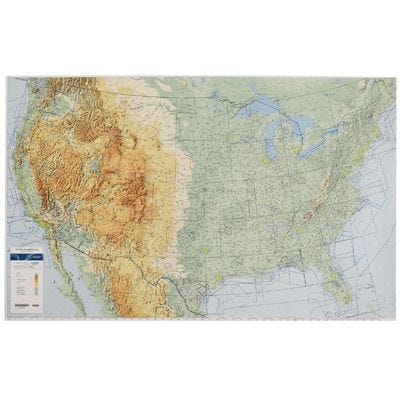
Laminated VFR Wall Planning Chart
Placeholder
$39.95
Backordered: Expected 05/29/2026
Backordered
This all-new chart is a great way to plan your next cross country flight.
This all-new chart is a great way to plan your next cross-country flight. Printed in full color, the map displays important land data like terrain, major roads, and cities. Aeronautical data includes all airports with runways greater than 4000’, navaids, class B airspace, and special-use airspace like MOAs and Restricted Areas. Airports include a three-letter identifier for easy GPS planning. Measures 59” x 36” and ships rolled. 1:3100000 scale. A great replacement for the popular JNCA-5 chart. Chart good until 11/27/25.
This Laminated version will keep your chart looking new.
This Laminated version will keep your chart looking new.


