Includes course access for yourself with your Sporty's account immediately after checkout.
We'll ship you or the recipient of your choice an online activation code for this course. This physical gift packet includes one activation code and directions on redeeming the course.
We can email the recipient of your choice instant online access to the course. This is the easiest way to send someone else the course as a gift.
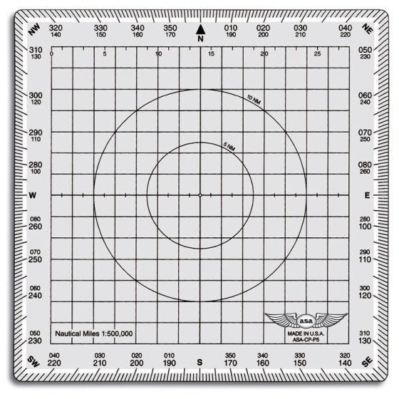
Constructed of durable Lexan®, this plotter won't melt, warp or break in extreme temperatures. Its convenient 5-1/8" square size and ease of use make this plotter a pilot favorite for simple, accurate flight planning. Uses a 1:500,000 scale and includes 5 NM and 10 NM radius rings for quick and easy measurement. The 2 NM grid makes alignment with parallels simple.
Features:
Durable Lexan resin won't melt, warp or break in extreme temperatures
Includes 5 NM and 10 NM radius rings for quick and easy measurement
2 NM grid makes alignment simple
Instructions for use:
Draw a line on your navigational chart using the straight edge to connect points which define your route of flight. Use the scale at the top to determine distance. Place center of plotter over the course line and slide plotter along route until grid lines on the plotter align with (or are parallel to) a nearby line of latitude or longitude. Note direction of flight and read true course on outer compass rose. Apply variation and wind correction to determine magnetic heading.
Measures 5 1/8" square. ASA part number ASA-CP-P5.
Reviews
Questions & Answers
SHOPPING MADE EASY
SAME-DAY SHIPPING
QUALITY TESTED PRODUCTS
BEST PRICE PROMISE
What we offer
Sign up for Special Offers
Stay up to date on new arrivals, email exclusives, and more.