Stay current with Sectional Charts from Sporty's. Updated every 56 days.
Always current charts
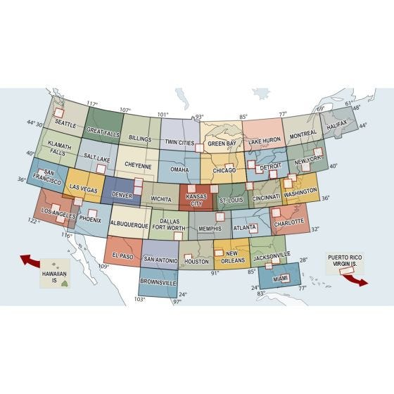
Paper sectional charts are an essential part of a pilot’s flight bag, and the most popular chart for VFR navigation. Most students learn with paper charts before moving on to an electronic solution, and paper charts are great for planning cross country flights and make a good backup for when electronics fail. Each sectional depicts land data like cities, rivers, roads, railroads, distinctive landmarks and topography. Aeronautical information on Sectional Charts includes visual and radio aids to navigation, airports, controlled airspace, restricted areas, obstructions, and related data. Revised every 56 days. You will receive only current, up-to-date charts. Since some charts are occasionally out of print, they will be back-ordered and shipped when in print.
Scale: 1:500,000
Nautical miles per inch: 6.86
Nautical miles per centimeter: 2.70
Subscription Service
Take the worry out of keeping your charts current and let Sporty's do the work for you. We can automatically send you new charts as they come available. See ordering instructions below.
Ordering information
Choose the coverage areas you need.
Enter the desired quantity next to each chart.
Choose which version of the chart you need:
Current Chart Only - you will receive the current chart (note obsolete date at top of page)
Current Chart With Subscription - you will receive the current chart and start a subscription for this chart